 |
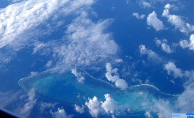
| James Shoal, totally submerges |
Where is the "southernmost point of Chinese territory"? It's a controversial question and the least controversial answer might be Hainan Island . More controversial options would be the Paracel (Xisha) islands or the Spratlys (Nansha). But officially the southernmost point is even further south - as far south as the James Shoal, about 100 kilometres from the coast of Borneo. What's more surprising is that this piece of the motherland is actually invisible. There's nothing there to see, unless you have diving equipment.
The James Shoal lies 22 metres below sea. Yet this inconvenience doesn't prevent PLA Navy ships visiting the shoal from time to time to demonstrate Chinese sovereignty over it. This ritual involves heaving a large piece of engraved stone over the side of the ship. There is now a small collection of Chinese stelae gathering organic encrustations on the sea floor, more than 1,000 kilometres from Hainan.
 |
| James Shoal, Zēngmǔ Ànshā (曾母暗沙) |
How did the Chinese state come to regard this obscure feature, so far from home, as its southernmost point? I've been researching the question for some time while writing a book on the South China Sea. The most likely answer seems to be that it was probably the result of a translation error.
In the 1930s, China was engulfed in waves of nationalist anxiety. The predation of the Western powers and imperial Japan, and the inability of the Republic of China to do anything meaningful to stop them, caused anger both in the streets and the corridors of power. In 1933, the republic created the "Inspection Committee for Land and Water Maps" to formally list, describe and map every part of Chinese territory. It was an attempt to assert sovereignty over the republic's vast territory.
The major problem facing the committee, at least in the South China Sea, was that it had no means of actually surveying any of the features it wanted to claim. Instead, the committee simply copied the existing British charts and changed the names of the islands to make them sound Chinese. We know they did this because the committee's map included about 20 mistakes that appeared on the British map - features that in later, better surveys were found not to actually exist.
The committee gave some of the Spratly islands Chinese names. North Danger Reef became Beixian (the Chinese translation of "north danger"), Antelope Reef became Lingyang (the Chinese word for antelope). Other names were just transliterated so, for example, Spratly Island became Sipulateli and James Shoal became Zengmu. And this seems to be where the mistakes crept in.
But how to translate "shoal"? It's a nautical word meaning an area of shallow sea where waves "shoal" up. Sailors would see a strange area of choppy water in the middle of the ocean and know the area was shallow and therefore dangerous. James Shoal is one of many similar features in the Spratlys.
But the committee didn't seem to understand this obscure English term because they translated "shoal" as " tan" - the Chinese word for beach or sandbank - a feature which is usually above water. The committee, never having visited the area, seems to have declared James Shoal/Zengmu Tan to be a piece of land and therefore a piece of China.
In 1947, the republic's cartographers revisited the question of China's ocean frontier, drawing up what would become known as the "U-shaped line". It seems that they looked at the list of Chinese names, assumed that Zengmu Tan was above water and included it within the line. A non-existent island became the country's southernmost territory.
But in a parallel process around the same time, the republic government gave new names to many of the sea features. Spratly Islands became Nanwei (the noble south), for example, and James Shoal was changed from a sandbank ( tan) into a reef ( ansha). Perhaps, by this time, the authorities had realised their mistake. Nonetheless Zengmu Ansha retained its official southernmost status.
By now, the translation error had become a fact, setting the region on course for conflict 80 years later.
This is more than a piece of historical trivia; James Shoal is a test of whether Beijing really is committed to the rule of international law in the South China Sea. Under the United Nations Convention on the Law of the Sea, no state can claim sovereignty over an underwater feature unless it lies within 12 nautical miles of its land. James Shoal is over 1,000 kilometres from undisputed Chinese territory.
Last month, the Philippines government announced it would seek a ruling from an international tribunal about whether China's claims in the sea were compatible with the UN convention. James Shoal would be a clear example of a claim that is not compatible. Perhaps this might be a good moment for Beijing to review how it came to claim this obscure piece of submarine territory in the first place.
Bill Hayton is writing a book on the South China Sea for publication later this year
This article appeared in the South China Morning Post print edition as How a non-existent island became China's southernmost territory
PUBLISHED : Saturday, 09 February, 2013, 12:00am
UPDATED : Saturday, 09 February, 2013, 6:37am
Bill Hayton
No comments:
Post a Comment